Estimated reading time: 8 minutes
Last week Winnie and I took a two-night RV trip up to Damascus, Virginia, and rode our bikes. The ride, on the Virginia Creeper Trail, was on one of the most beautiful “Rail-to-Trail” lines I’ve seen. It also was the longest one-day bike ride I’ve made. Winnie and I ended up a bit sore afterwards, but it was well worth the trip.
Getting There
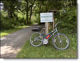
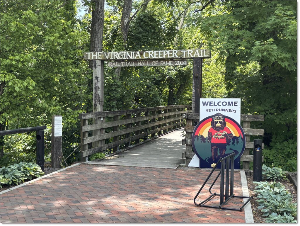
I’ve been reading about the Virginia Creeper Trail since last year. It’s described as “a scenic 34-mile rail-to-trail recreation site in Southwest Virginia, stretching from Abingdon, Virginia, to Whitetop Station, Virginia. Unfortunately, a section of this trail between Whitetop Station and Damascus, Virginia, was washed out during Hurricane Helene in 2024. It’s being repaired, but for now only the 17-mile section between Damascus and Abingdon is open.
So, a few weeks ago we decided on a bicycle date and I made RV reservations at a small RV park right in the center of downtown Damascus. The town is a three-and-a-half-hour drive north from us, an easy trip. It’s also in a part of the U.S. I’ve never previously explored.
Damascus RV Camping
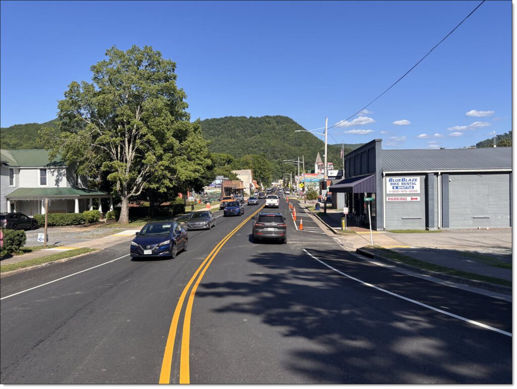
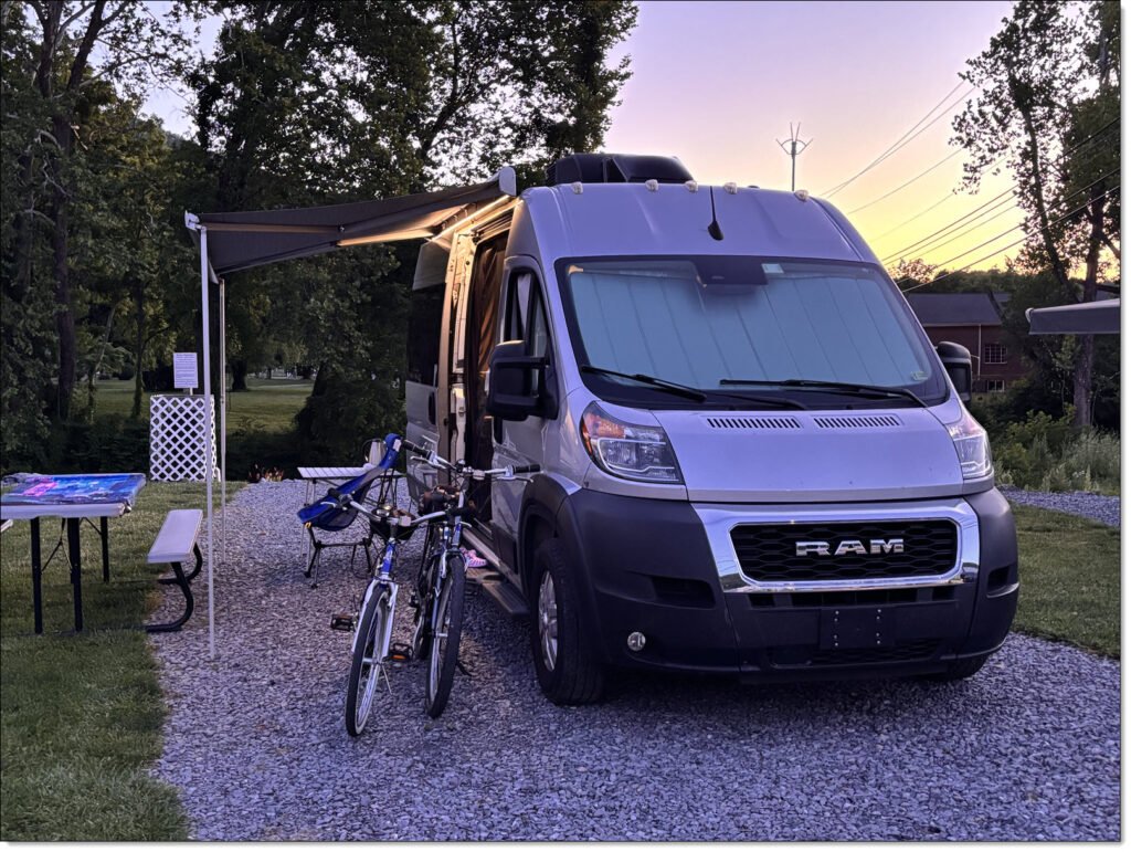
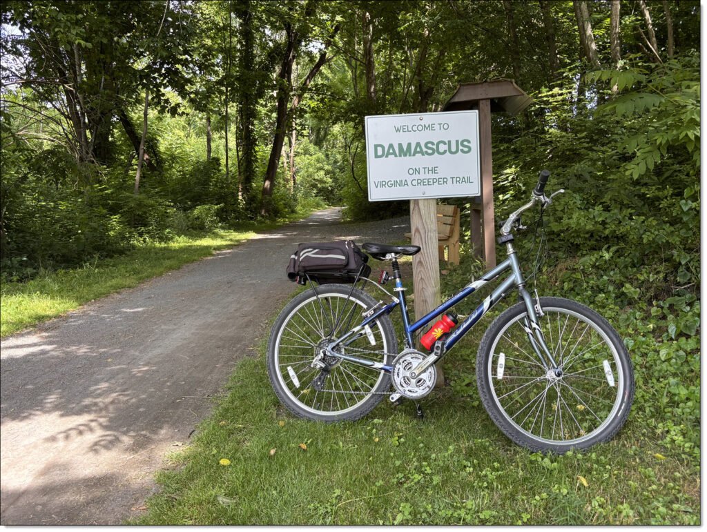
Damascus is a pleasant town of just under 800 people, nestled in the Appalachian Mountains near the Blue Ridge Parkway. It is literally a one-road town built along Highway 58, named “Laurel Avenue” (helpfully divided into “East Laurel” and “West Laurel” based on crossing Laurel Creek) for the one-half-mile stretch through the town. We camped at Damascus Creekside RV Park, on East Laurel Avenue next to Laurel Creek.
This RV park has only ten sites, with a “Bed and Breakfast” feeling to it. Unfortunately, Highway 58/Laurel Avenue happens to be a busy road so we had to deal with highway noises most of each night there. I can pretty much sleep through anything. Winnie, not so much. But it was an otherwise pleasant RV camp. We were only about one-half mile from the Virginia Creeper Trailhead, so we could leave our RV parked for the both nights we were there.
We drove up on a Thursday, settled in for the evening. Next morning we cleaned up and hit the trail about 10:00.
The Virginia Creeper Trail
The trail is built on a former railway line initially laid out about 1880 to haul timber and iron ore. The original owners went bankrupt, and the line was sold and expanded by a private venture in 1900, then sold to Norfolk & Western (“N&W”) about 1919. The line operated until 1977, when it was no longer profitable and N&W was allowed to shut it down.
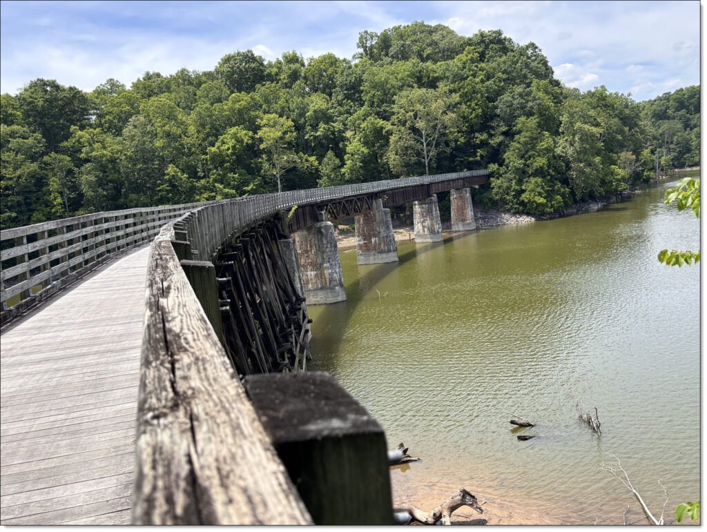
Over the next ten years, various agencies and private groups purchased pieces of the rail right-of-way, and by 1987 the Virginia Creeper Trail was dedicated as a National Recreation Trail. By 1989 the present-day trail from Whitetop Station to Abingdon was opened. The entire 32-mile trail winds through the Appalachian Mountains and has 47 trestle bridges crossing rivers and valleys.
The section between Damascus and Abingdon is advertised as being relatively flat, with seventeen trestle bridges along the way. These trestle bridges are restored from the original 1900s railway.
Damascus to Abingdon
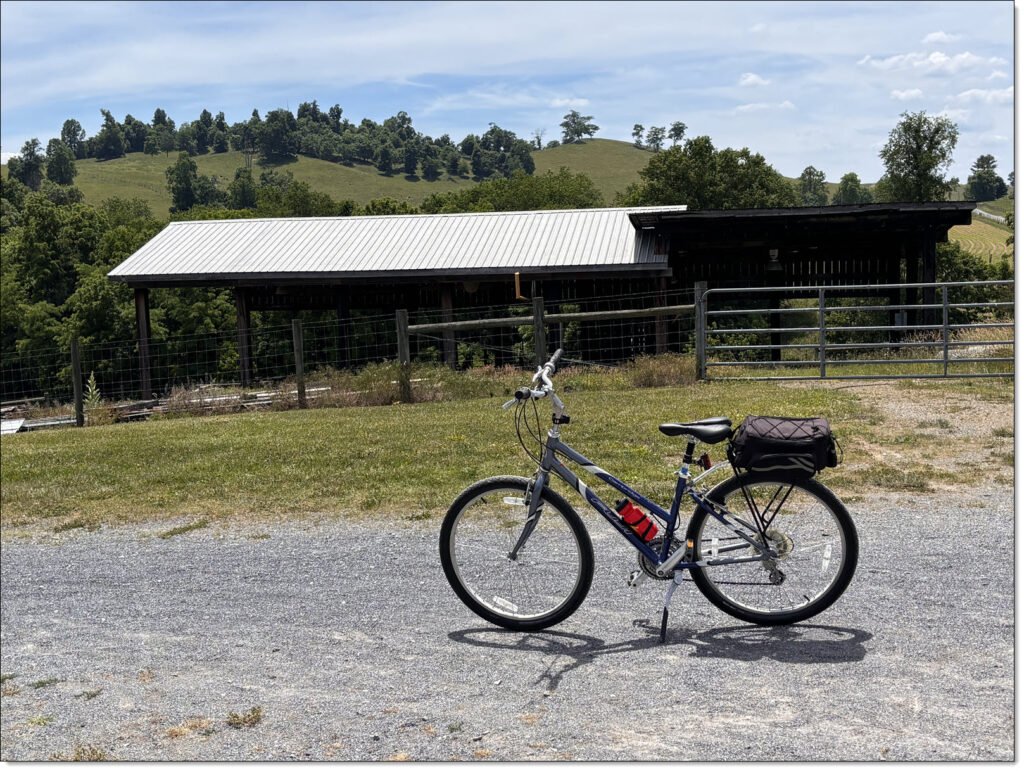
There are a number of bike shops in Damascus and Abingdon that rent bikes and drop people off at various spots along the trail. My initial plan was to get dropped off in Abingdon and ride the 17 miles one-way back to Damascus. Given I’m only (periodically) riding ten miles around Charlotte, I felt 17 miles was already as much as Winnie and I could handle. Winnie insisted she was able to handle the entire round trip, and insisted that I could also handle it.
So, we made the entire round-trip bike ride.
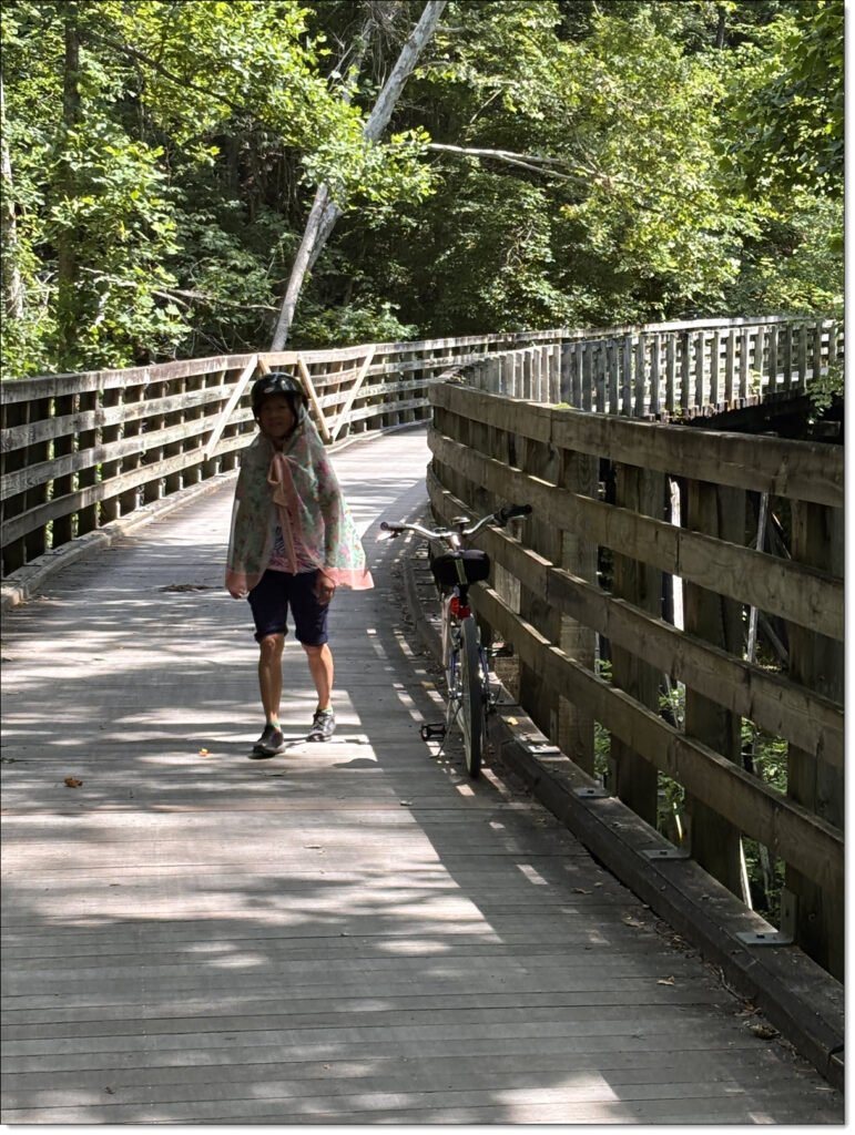
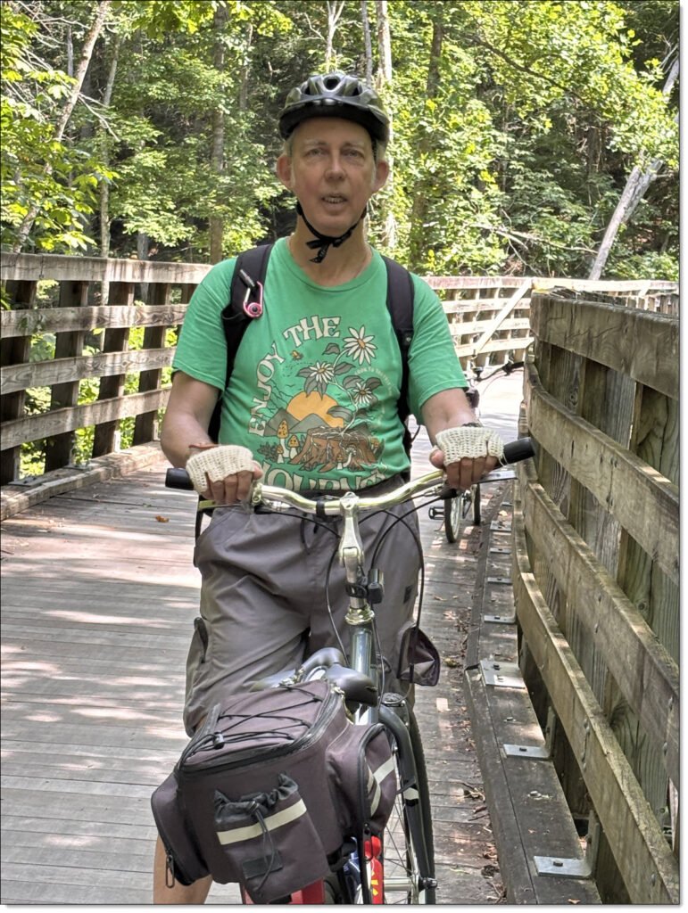
The trail started out tucked between highway 58 and Laurel Creek, then gradually veered away from the highway and deeper into farmlands, rolling hills, and wooded areas. Periodically we crossed old railroad trestle bridges. We did take our time peddling, with periodic breaks for pictures and rest.
The last eight miles or so into Abingdon was slightly uphill, but not enough to be a problem of either of us.
Abingdon
After a two-plus hour ride, we arrived in Abingdon. This town is considerably larger than Damascus, with a population over 8,000 and lots of main roads.
We were both a bit tired by this point. I was carrying lunch in my backpack, so we pulled into a small park next to the trailhead and had a well-earned reward. After lunch, we pedaled around the area and checked out eBikes in a nearby bike shop. We had seen a lot of riders on eBikes along the trail, and Winnie was getting interested in them.
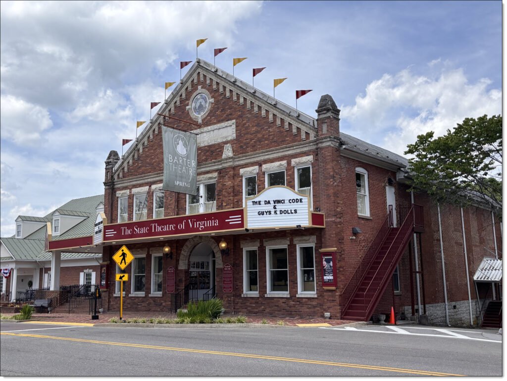
We went a few more blocks into Abington, far enough to see Barter Theatre, considered one of the major attractions in Abingdon.
The Road Home
By this time, Winnie and I were both feeling the bike riding. We decided it was time for the 17-mile ride peddle back to Damascus.
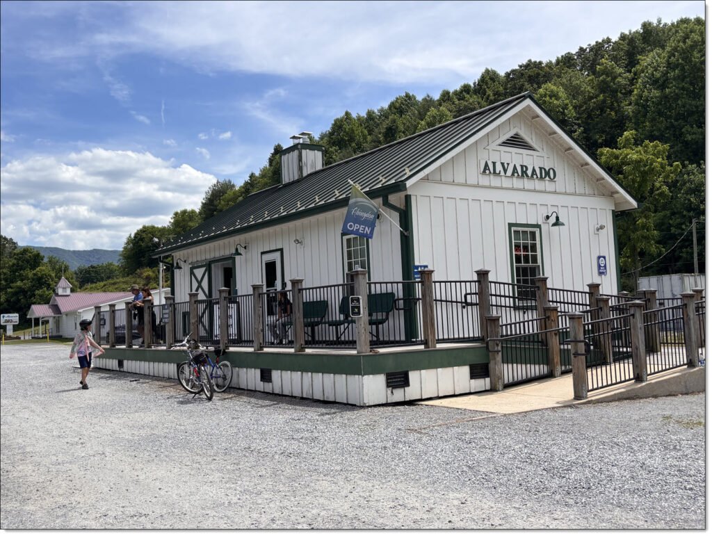
What goes up must come down, and the trail did work in our favor. The eight-mile uphill stretch coming to Abingdon was eight miles downhill on the way back. We continued to make periodic water stops. About halfway back we did stop at the general store in Alvarado for ice cream.
Return To Damascus
As we got closer to Damascus, Winnie made several stops to inspect the wildflowers growing along this section of the trail. I didn’t mind these stops, as I was beginning to feel a serious case of saddle sores. But, we did make it back in time for dinner and a well-earned nights rest.
We headed for home the next morning talking about coming back next year to ride the stretch between Whitetop Station and Damascus.
Related Posts
Outside Links
The Virginia Creeper Trail Conservancy (VCTC): A volunteer organization formed two-years after the trail officially opened in 1987, to help maintain the trail and to supplement the efforts of the local towns and small communities’ staffs and budgets.